How to use drones for leisure and professional photography.
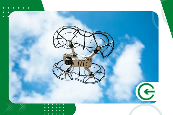
The decision to Using drones for leisure It has transformed the way we capture memories and explore the world around us.
ADVERTISING
This technology has gone from being an exclusive niche to becoming accessible, allowing for impressive aerial footage.
Whether capturing family trips or starting a career in photography, understanding the fundamentals of flight is essential. The learning curve has decreased dramatically with new AI-assisted stabilization systems.
In this comprehensive guide, we will explore best practices for beginner and enthusiast pilots seeking professional quality. We will cover everything from current Brazilian legislation to advanced aerial photography composition techniques.
Summary:
advertising
- The regulatory landscape in Brazil (2025)
- Differences between recreational and professional equipment
- Flight and photography techniques
- Planning and safety
- Comparative table of categories
- FAQ
What are the legal requirements for flying drones in Brazil?
Before taking off, it is essential to understand that airspace is a regulated and shared environment. Brazil has strict rules established by ANAC (National Civil Aviation Agency) and DECEA.
To Using drones for leisure For your work, you must register the equipment with Anatel, ensuring that it does not interfere with other frequencies. This is the first bureaucratic step to avoid tax seizures.
Next, all drones weighing more than 250g must be registered in SISANT, the ANAC system. This registration generates a unique identification that must be affixed to the aircraft's body.
Furthermore, each flight requires a request for airspace access through the SARPAS system. Today, this authorization is almost immediate for recreational flights in low-risk areas.
Ignoring these rules can result in severe fines and criminal prosecution, especially if there is a risk to third parties. Civil liability is a non-negotiable principle for any unmanned aircraft operator.
Compliance with no-fly zones, such as airports and prisons, is monitored electronically. Modern drones have systems that... Geofencing which automatically prevent takeoff in these restricted areas.
To deepen your understanding of current regulations and avoid legal problems, consult the official website. Access the complete DECEA guidelines here..
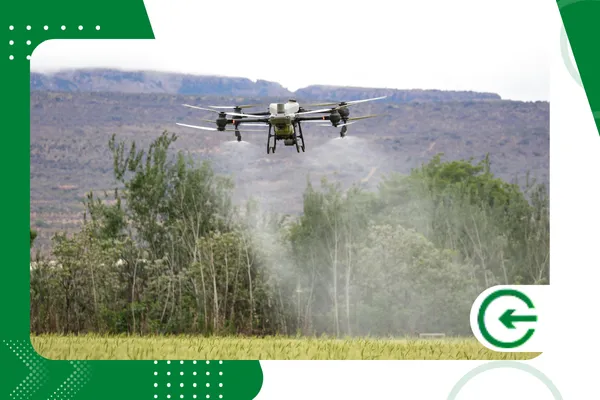
Which drone model fits your specific needs?
Choosing the ideal equipment depends directly on your ultimate goal, whether it's extreme portability or cinematic image quality. The market in 2025 is clearly divided between "Mini" drones and "Pro" lines.
Models in the "Mini" category generally weigh less than 249g, which simplifies regulations in several countries. They are ideal for those who want... Using drones for leisure without carrying heavy backpacks.
Despite their small size, these remarkable little cameras already offer 4K recording and sensors capable of capturing RAW photos. Three-axis mechanical image stabilization ensures smooth videos, eliminating unwanted shaking.
On the other hand, professional drones have larger sensors, usually 1 inch or Micro Four Thirds. This allows for superior light capture, essential for night work or large-format printing.
Another advantage of the larger models is wind resistance, allowing for stable flights even in adverse weather conditions. The battery life in these models also usually exceeds 40 minutes of actual flight time.
Omnidirectional obstacle detection systems are standard in professional equipment, protecting your investment against collisions. This technology uses computer vision to autonomously plot safe routes during the return to the point of origin.
+ How small Brazilian businesses are using hybrid cloud.
How does lighting affect aerial photography quality?
Light is the raw material of photography, and in the sky, the rules of lighting change drastically. Understanding the sun's position is vital to avoid harsh shadows that obscure important details of the landscape.
The "Golden Hour," just after sunrise or before sunset, offers the softest light. The elongated shadows create interesting textures on the ground, adding depth and drama to the compositions.
To the Using drones for leisure At midday, the midday sun can leave images "washed out" and lacking contrast. At this time, the water's surface also reflects a lot of light, hindering visibility of the bottom.
To counteract excessive brightness, the use of ND (Neutral Density) filters is mandatory for aerial cinematographers. They function like sunglasses for the lens, allowing the use of cinematic shutter speeds.
The 180-degree rule in video requires the shutter speed to be twice the frame rate. Without ND filters, this would be impossible on sunny days without overexposing the image.
In addition to natural light, light pollution in cities can be a creative element for long-exposure night photography. Light trails from cars on highways, seen from above, create hypnotic visual effects.
+ Game Streaming: How It Works and Why It's Growing
Why is post-processing crucial for professional results?
Capturing the image is only half the creative process in modern high-performance drone photography. The raw (RAW) file contains all the light and color information, but it needs to be "developed."
Editing software allows you to recover details in shadows and enhance the colors of the sky without creating digital artifacts. This flexibility is what separates an amateur photo from an image worthy of a portfolio.
To the Using drones for leisureMany pilots are content with ready-made JPEGs, but they miss out on the dynamic richness of the scene. The D-Log format in videos, for example, delivers a deliberately washed-out image to facilitate subsequent color grading.
Lens distortion correction is also done in post-production, ensuring straight and natural horizons. Wide-angle lenses tend to curve the edges, which can be undesirable in architecture or real estate.
Intelligent cropping can salvage a composition that wasn't perfect during the original flight. With high-resolution sensors, it's possible to enlarge parts of the image without significant loss of visual quality.
HDR (High Dynamic Range) techniques and panoramic Automated processes require the merging of multiple photos on a computer. The result is images with a dynamic range that the human eye could not process on its own.
What are the best practices for flight safety?
Safety must be the number one priority, regardless of pilot experience or onboard technology. Complacency is the biggest cause of accidents, usually occurring when the operator underestimates the environment.
Always check the KP index, which measures solar geomagnetic activity, before initiating any flight operation. Solar storms can interfere with GPS, causing loss of control and "flyaways" (uncontrolled flights).
Inspect the propellers thoroughly before each takeoff, looking for small scratches or signs of plastic wear. A propeller failure at maximum rotation can destabilize the aircraft and cause a fatal crash.
Always keep the drone within your visual line of sight (VLOS), as required by current Brazilian legislation. Flying while only looking at the controller screen reduces depth perception and the ability to perceive lateral obstacles.
Monitor the battery voltage, don't rely solely on the percentage displayed in the control app interface. Strong winds require more power from the motors to maintain position, draining the battery quickly.
Landing with 20% of charge remaining is a recommended safety margin to avoid unforeseen problems on the return trip. Lithium Polymer (LiPo) batteries should not be completely drained to preserve their lifespan.
+ How to Protect Your Data When Using Public Wi-Fi
Table: Comparison of Drone Categories (2025)
Below, we present real market data to help with purchase decisions based on usage profiles.
| Category | Average Weight | Camera Sensor | Wind Resistance | Main Use | Registration Required (BR) |
| Ultralight | < 249g | 1/1.3″ CMOS | Level 5 (38 km/h) | Travel, Social Networks | Anatel only (SISANT optional) |
| Intermediary | 500g – 750g | 1/1.3″ or 1″ CMOS | Level 6 (45 km/h) | Real Estate, Events | Anatel + SISANT + SARPAS |
| Professional | 900g+ | 4/3 CMOS (Hasselblad) | Level 6+ (50 km/h) | Cinema, Advertising | Anatel + SISANT + SARPAS |
| FPV (Hybrid) | 400g – 800g | 1/1.3″ CMOS | Level 5 (Varies) | Dynamic shots, Sports | Anatel + SISANT + SARPAS |
Note: The registration requirement refers to standard recreational use. Commercial use (aerial surveying) requires additional registration with the Ministry of Defense.
Conclusion
Unmanned aerial vehicle technology has democratized access to perspectives previously restricted to large helicopters. Using drones for leisure It's a fascinating gateway to a world of technical creativity.
Mastering aerial photography requires patience, constant study of weather conditions, and absolute respect for safety regulations. Advances in sensors and artificial intelligence facilitate the process, but do not replace the human eye.
By investing in quality equipment and dedicating time to learning editing, the results will be amazing. Drone photography is, above all, a new way to tell impactful visual stories.
To stay up-to-date on technological innovations and new sensor releases, we recommend following specialized sources. Check out the latest news on the official DJI website., a world leader in the segment.
FAQ (Frequently Asked Questions)
1. Can I fly my drone anywhere in the city?
No. It is prohibited to fly over people without consent, near prisons, airports, or security facilities. You should consult the DECEA/SARPAS map to verify if the area allows recreational flight.
2. What happens if the battery dies during the flight?
Modern drones have a "Return to Home" (RTH) function that is activated when the battery reaches a critical level. The aircraft calculates the energy needed to return and automatically initiates the return before crashing.
3. Do I need a course to fly drones for recreation?
It is not legally required to have a pilot's course or license (CAER) for recreational flights below 250g. However, knowledge of airspace rules is mandatory for all operators, regardless of class.
4. Can drones fly in the rain?
Most consumer drones are not waterproof and have ventilation openings for the electronic components. Flying in the rain can cause immediate short circuits and total loss of the equipment, as well as voiding the warranty.
5. What is the maximum permitted altitude for recreational flights?
In Brazil, the altitude limit for recreational flights without special authorization is 120 meters (400 feet) above the ground. Flying above this interferes with manned aircraft routes and constitutes a crime against air safety.